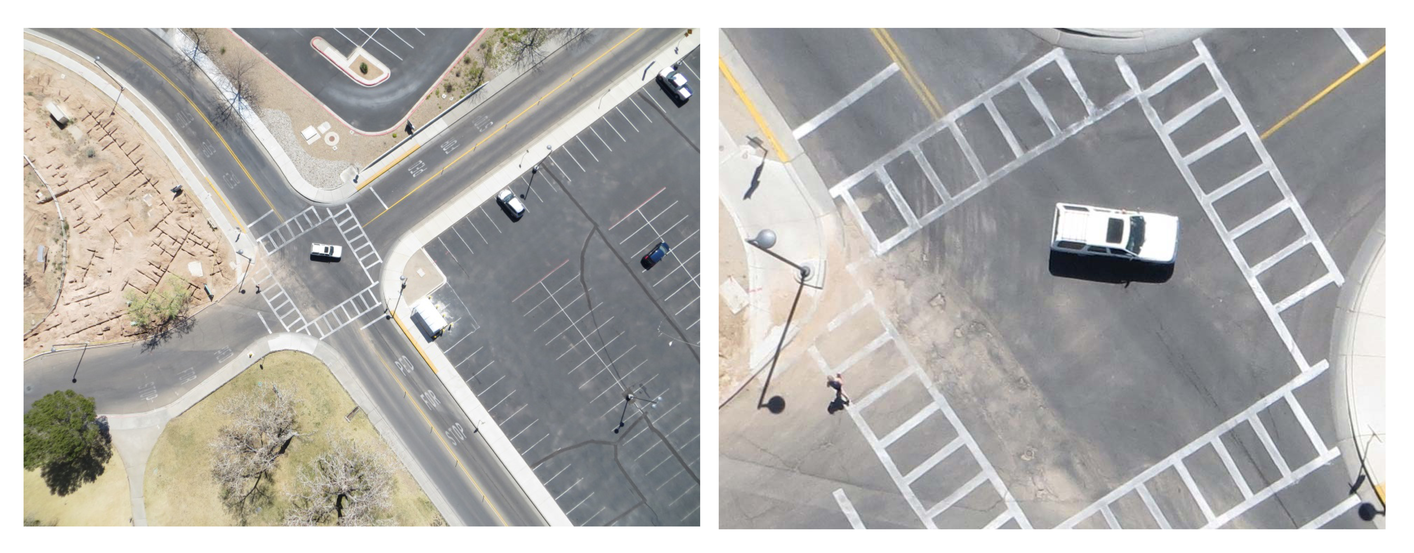
EDAC has a fleet of small unmanned aircraft systems (sUAS) to conduct a complete end-to-end high-spatial-resolution aerial data collection. EDAC can collect, process, analyze, and distribute high-spatial resolution (1 cm or higher) aerial images, digital surface models (DSMs), and digital elevation models (DEMs) rapidly and accurately, and at a fraction of the cost of traditional ground-based survey methods. EDAC has a crew of FAA-certified sUAS operators to provide professional services to public sector clients in local, county, and state governments, as well as private sector clients in the construction, utilities, and transportation industries.