Current vs. Proposed Data
The imagery on the left is the best, publicly available data. The imagery on the right is USGS Quality Level 2 lidar data.
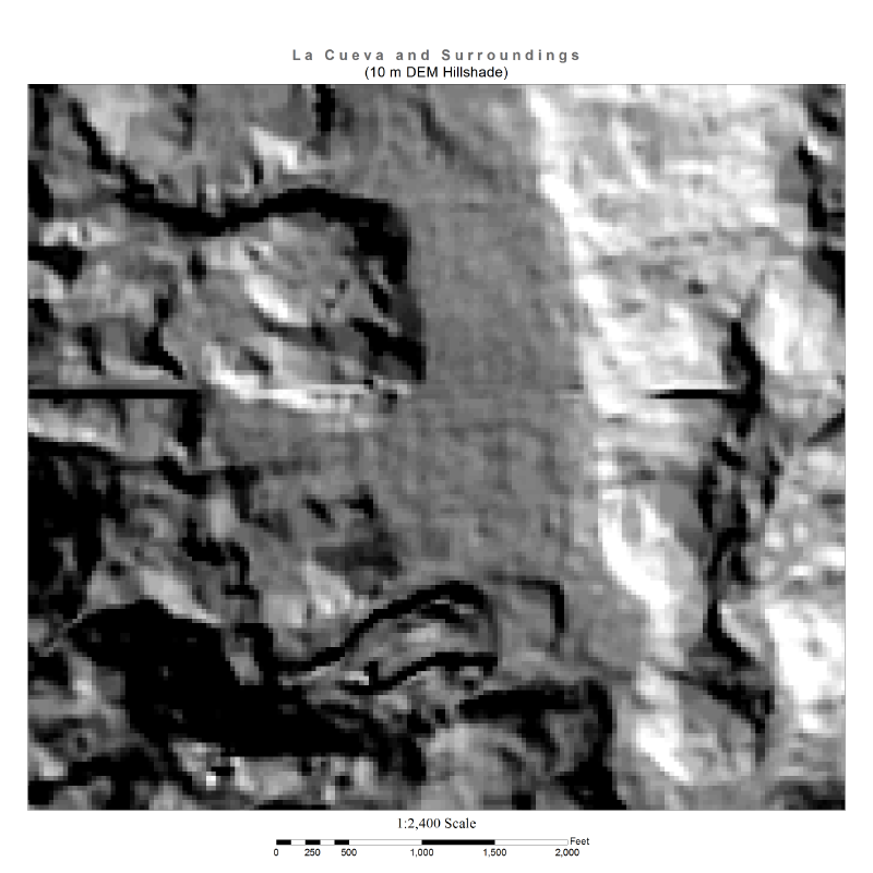
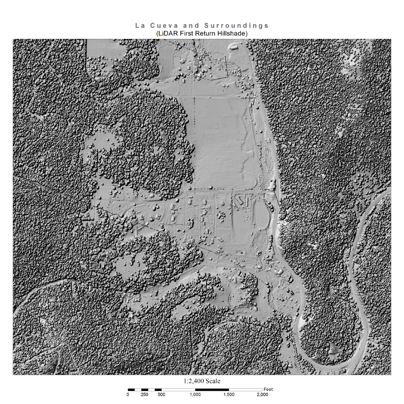
The current, best available elevation data for New Mexico is 10 meter data. Lidar data, collected at the USGS Quality Level 2, has a resolution approximately 10 times better. Use the sliders below to get a better sense of what lidar data is capable of. This data is from the La Cueva area in the Jemez Mountains.
The imagery on the left is the best, publicly available data. The imagery on the right is USGS Quality Level 2 lidar data.
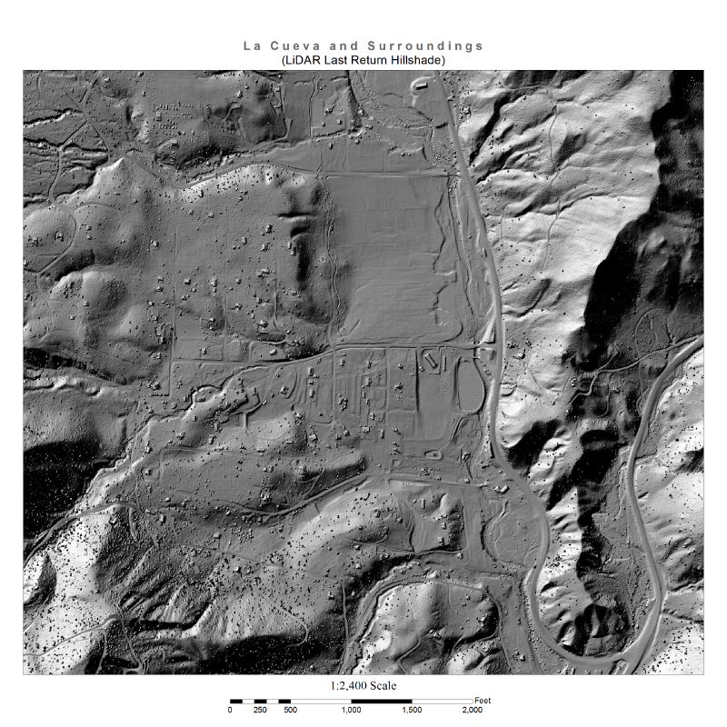
With lidar data, we can also remove surface items like buildings and vegetation to see what the bare earth looks like underneath.

More information about the USGS 3D Elevation Program can be found at http://nationalmap.gov/3DEP/.
New Mexico specific information can be found at (PDF) 3DEP Summary of New Mexico.